Quick start
The FEH Web Service provides the data and rainfall model outputs that are at the core of the flood estimation procedures provided by the Flood Estimation Handbook (FEH) and subsequent updates.
Data is provided at catchment or point scale. Please be aware of the differences in Catchments vs points, as they contain different data.
Retrieving data
-
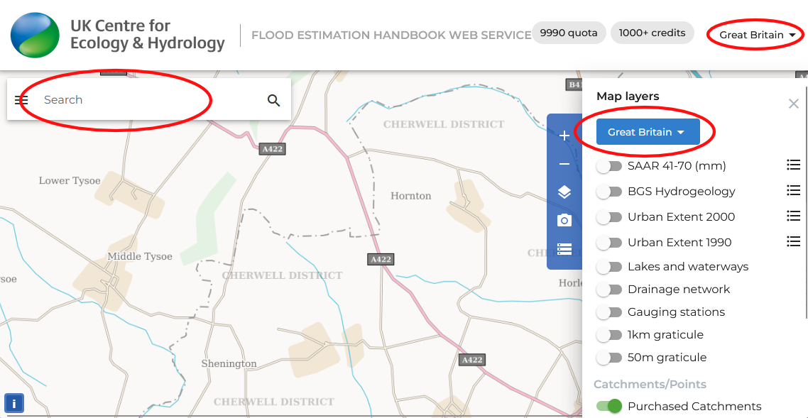
Open the map, choosing between Great Britain and Northern Ireland using the Map dropdown menu in the top right corner of the screen (Navigating around the map).
-
Identify the location you are interested in by moving the map or using the search bar in the top left corner of the screen. It might be useful to turn on the Drainage network layer in the Map layers menu in the navigation panel on the right side of the screen.
-
Right click
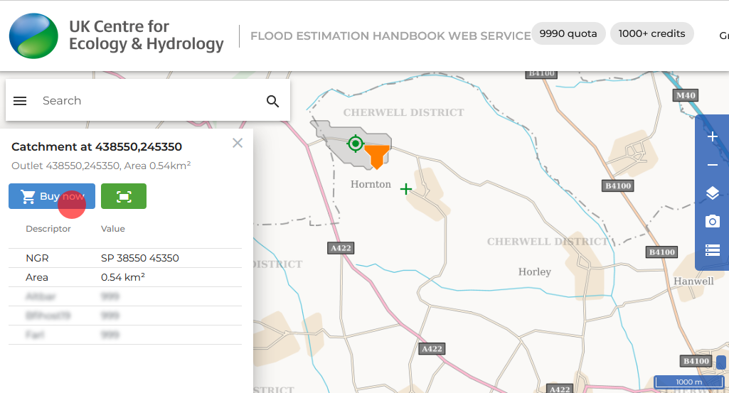
 on the location of your choice and choose between Catchment data or Point data.
- Check if this is the correct catchment/point you are looking for and when you are satisfied click the Buy now button. If you're not logged in you'll need to Set up or log in to your account and ensure you have sufficient credits.
Once a catchment or point has been purchased, it remains associated with your account granting you perpetual access to the data.
Viewing data
To view the data, click on a purchased catchment/point icon in the map. A window will appear on the left side of the screen with the catchment/point descriptor information. Here, you can also:
 access the DDF rainfall modelling screen
 export the data
 for catchments, zoom to the catchment boundary extent
You can also view and search for previously purchased catchments/points, using the Data Management tool by clicking on the three lines icon in the navigation panel on the right side of the screen.